This walk was organised and led by me as a private walk for me. Getting there - easy, start from home.
Walk
I have recently discovered the Get out there! brochure published by the ACT Government - both web version and glossy coloured booklet. It's a ripper! The Canberra Nature Park 34 entries provide great opportunities for little walks when one is generally restricted by visitors. Today's little wander took me from home to my brother-in-law's where I met my family for tea. I only had to leave 3 hours earlier.
From home, up Warragamba Avenue to the top of Duffy and up the path to Narrabundah Hill. Narrabundah Hill is nowhere near Narrabundah. My sister regularly walks here. David and Meredith H (who sometimes walk with me) helped re-green this hill, David carrying up water to keep the seedlings alive. Beautiful views from here and all along the Cooleman Ridge to the W (see Facebook) - whoever would have thought it could be so green at Christmas time?
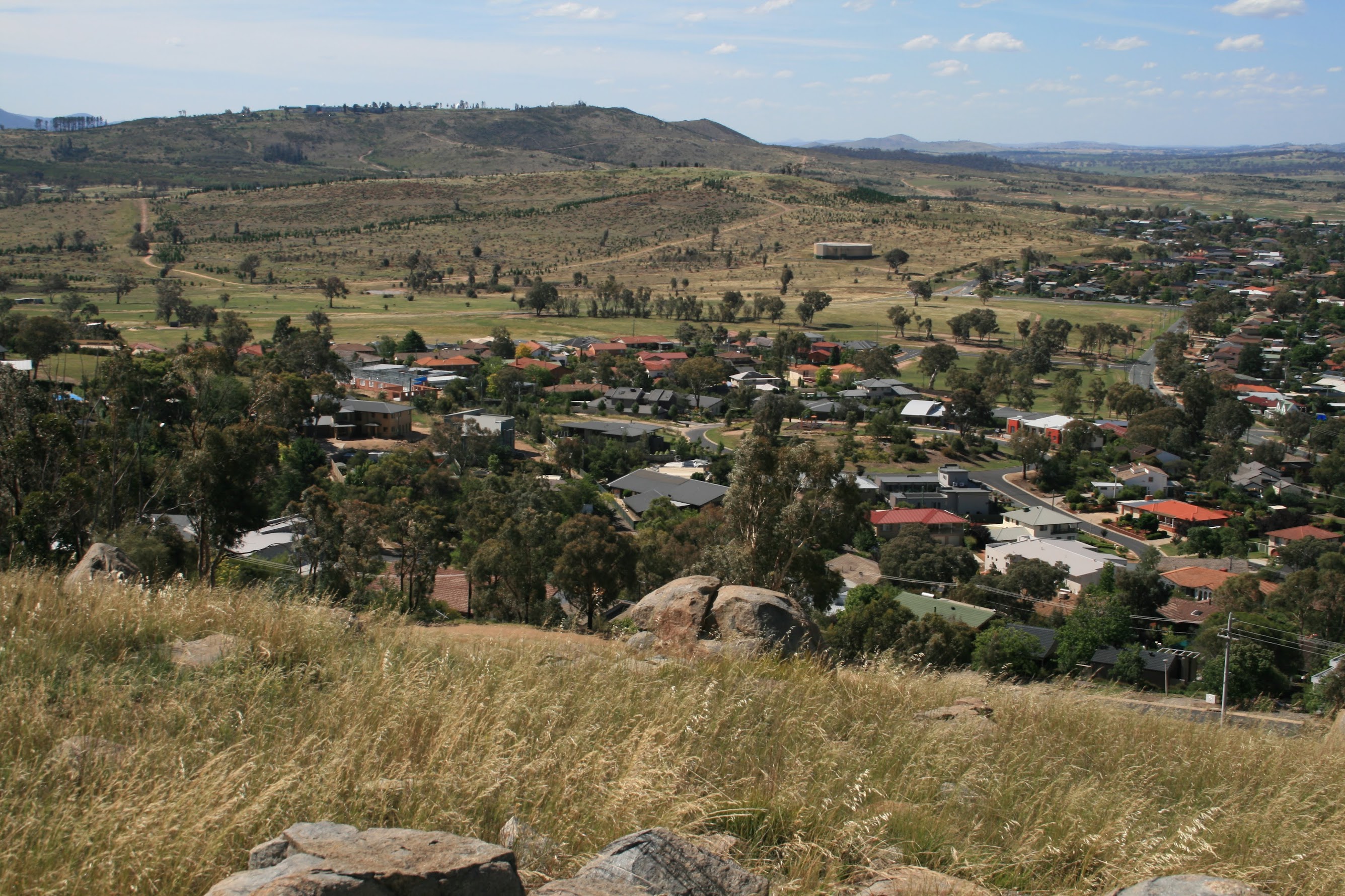
S down off the hill and skirted to the E of the leasehold National Equestrian Centre and so to the top of Kathner St where the Cooleman Ridge starts. The Canberra Nature Park map for the Cooleman Ridge Nature Reserve is here. At the entry point a box with a brochure for the Cooleman Ridge Nature Trail, brochure on the web here. Hats off to these folk who work hard so that we might enjoy the ridge. See the web site of the Cooleman Ridge Park Care Group here. The trail generally contours at a lower level - I followed it for a while, then headed up the spine of the ridge to Cooleman Hill trig. Delightful views over green paddocks and ranges to the W (see Facebook), to the N along the way I'd come (see pic 1), E over the Weston Creek suburbs to Woden and Central Canberra and S along the ridge (see Facebook).
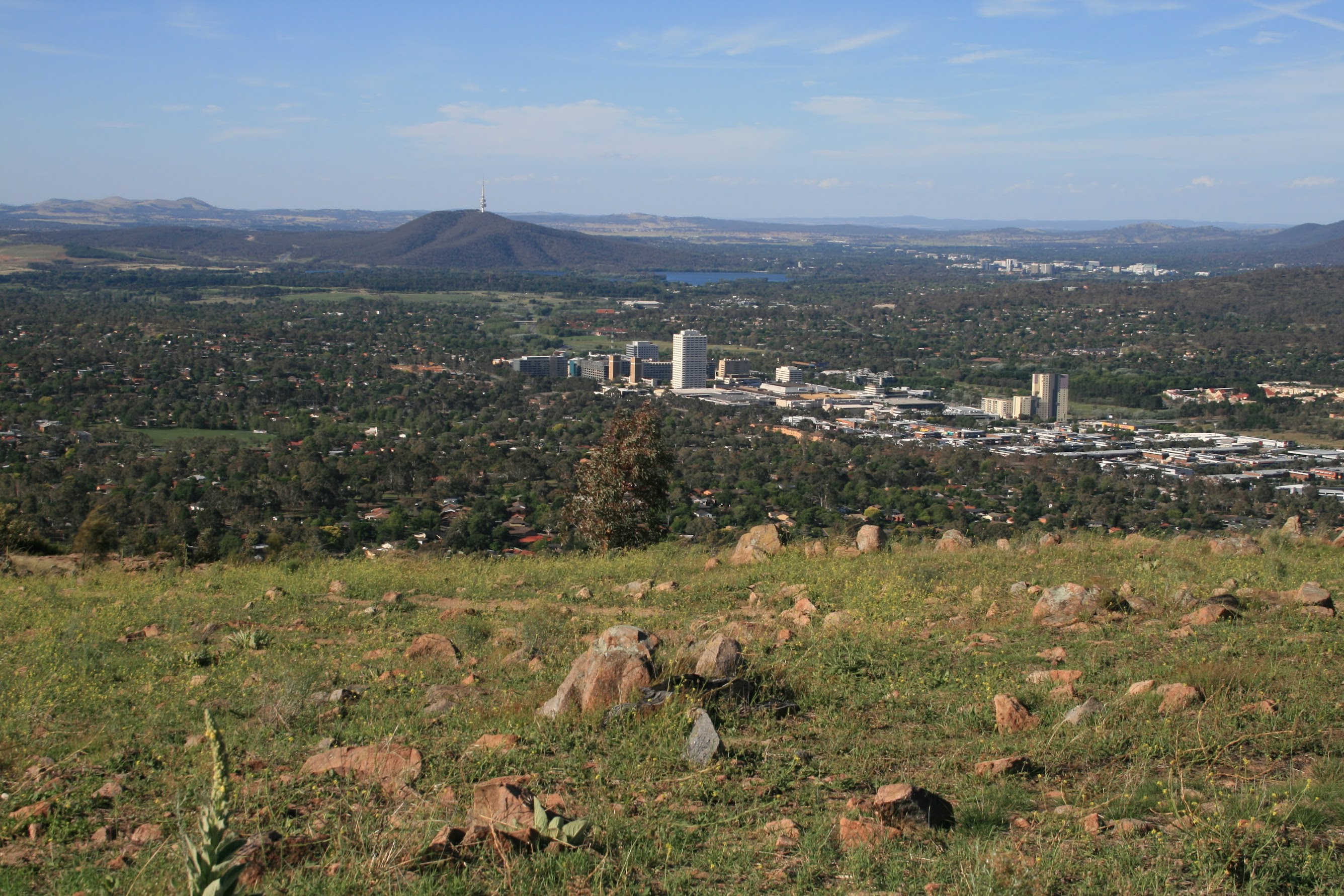
From here, generally S then SE, following trails and footpads along the ridge. The supurb views continued (see pic 2). A bit of a climb up to the Mt Arawang trig. Views, views, views (see Facebook).
I chose the track directly NE down to Namatjira Drive, as I thought I saw an underpass under the Tuggeranong Parkway. I'd originally planned to head S down the spine of the ridge to the Arawang horse paddocks, pass Parkway and cross at the lights. Wrong and long call, as there was a good 1km N along the side of the Tuggeranong Parkway to opposite Nemarang Crescent before I could get under.
No matter, a bit of Waldock St Pearce, then onto trails and footpads that took me to the top of Mt Taylor. The Canberra Nature Park map for the Mt Taylor Nature Reserve is here. The excellent views kept coming (see pic 3 and Facebook). I 'bush bashed' to cut off the big loop in the main S Mt Taylor access track, came out near the SW corner of Torrens, headed S to cross Sulwood Drive and so down to my destination.
Undid all the good work (after a little water and a cool down) with beer, ham sandwiches, pavlova and coffee. A very pleasant little Canberra Nature Park (on this blog) wander.
Distance: 14.9km Climb: 500m. Time: 3.00-6.10pm (call it 3.25hrs) with no stops.
Grading: M/E; M(8)
KMZ file for Google Earth/Maps: Narrabunbdah Hill, Cooleman Ridge NR and Mt Taylor NR